 Whimsy Bike
Victoria Bike Map
Bike lanes, trails and calm streets in Victoria, BC, and a route planner that picks the comfortable way.
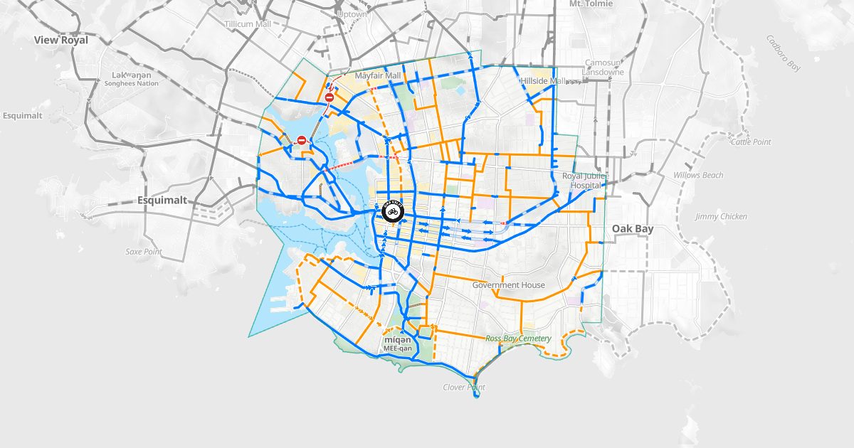
Bike routes in Victoria
About 101 km of mapped bike routes, 90% of them on protected lanes, trails, painted lanes or traffic-calmed streets.
| Protected lanes and paved trails | 38.9 km |
| Painted bike lanes | 22.6 km |
| Traffic-calmed streets | 27.4 km |
| Shared streets | 8.8 km |
| Unpaved trails | 2.0 km |
| Difficult connections | 1.2 km |
Main bike routes
- Blanshard St: 5.4 km, protected lanes and paved trails
- Fort St: 3.8 km, protected lanes and paved trails
- Dallas Road Waterfront Trail: 3.0 km, protected lanes and paved trails
- Galloping Goose Regional Trail: 2.7 km, protected lanes and paved trails
- Pandora Ave: 2.5 km, protected lanes and paved trails
- Johnson St: 2.5 km, painted bike lanes
- Cook St: 2.2 km, protected lanes and paved trails
- Government St: 2.0 km, protected lanes and paved trails
- Finlayson St: 2.0 km, painted bike lanes
- Shelbourne St: 2.0 km, protected lanes and paved trails
Rail trails
On the map
6 public bike repair stations; 23 public washrooms; 110 drinking fountains; Government House, Hillside Mall, Mayfair Mall, Ross Bay Cemetery, Royal Jubilee Hospital, míqən.
How Victoria's bike routes came to be
Victoria adopted its plan for an all ages and abilities bike network in 2016: about 33 km of protected lanes and calm streets. The first protected lane, on Pandora Avenue, opened on May 1, 2017, and passed a million trips within a few years. Fort Street's followed in May 2018, then Wharf and Humboldt streets. The new Johnson Street Bridge opened on March 31, 2018 with bike lanes and a multi-use path across the harbour to Victoria West, where the Galloping Goose and the E&N Rail Trail begin.
Plan a ride
Whimsy Bike plans routes across Victoria and the rest of Greater Victoria on your device. Comfortable routes favour protected lanes, trails and quiet streets; Balanced and Direct trade some comfort for distance. Every route explains why it was chosen.
Bike maps by area
- Victoria
- Saanich
- Oak Bay
- Esquimalt
- View Royal
- Langford
- Colwood
- Metchosin
- Sooke
- Highlands
- Central Saanich
- North Saanich
- Sidney