 Whimsy Bike
View Royal Bike Map
Bike lanes, trails and calm streets in View Royal, BC, and a route planner that picks the comfortable way.
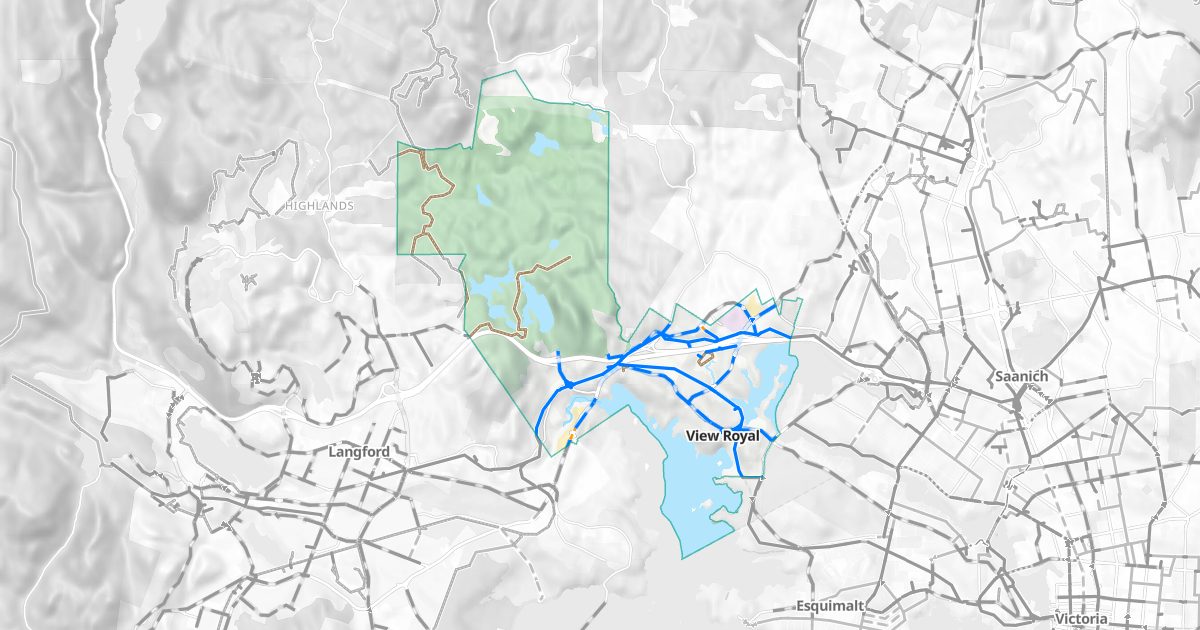
Bike routes in View Royal
About 37.2 km of mapped bike routes, 99% of them on protected lanes, trails, painted lanes or traffic-calmed streets.
| Protected lanes and paved trails | 11.9 km |
| Painted bike lanes | 10.7 km |
| Shared streets | 0.4 km |
| Unpaved trails | 14.2 km |
Main bike routes
- Island Hwy: 5.4 km, painted bike lanes
- Galloping Goose Regional Trail: 4.5 km, protected lanes and paved trails
- E&N Rail Trail - Humpback Connector: 3.0 km, protected lanes and paved trails
- Bellamy Trail: 2.6 km, unpaved trails
- Helmcken Rd: 2.4 km, painted bike lanes
- Watkiss Way: 1.9 km, painted bike lanes
- Lighthouse Extension: 1.7 km, unpaved trails
- Lighthouse: 1.3 km, unpaved trails
- Phelps Connector: 1.1 km, unpaved trails
- Trillium Trail: 1.0 km, unpaved trails
Rail trails
On the map
CFB Esquimalt, Thetis Lake, Victoria General Hospital.
How View Royal's bike routes came to be
View Royal is crossed by both rail trails heading west: the Galloping Goose, and the E&N Rail Trail's Humpback Connector, whose second phase, from the Four Mile Bridge on the Island Highway to the Galloping Goose, was finished in 2019.
Greater Victoria's bike network grew out of its old railways. The Galloping Goose Regional Trail was turned from a Canadian National line into a trail starting in 1987, the Lochside Regional Trail opened up the Saanich Peninsula in 2001, and the E&N Rail Trail has been built in phases beside the Esquimalt & Nanaimo line since 2009. In 2016 the City of Victoria adopted a plan for a network of bike routes for all ages and abilities, and its first protected lane, on Pandora Avenue, opened in 2017. Neighbouring municipalities have been adding protected lanes of their own since.
Plan a ride
Whimsy Bike plans routes across View Royal and the rest of Greater Victoria on your device. Comfortable routes favour protected lanes, trails and quiet streets; Balanced and Direct trade some comfort for distance. Every route explains why it was chosen.
Bike maps by area
- Victoria
- Saanich
- Oak Bay
- Esquimalt
- View Royal
- Langford
- Colwood
- Metchosin
- Sooke
- Highlands
- Central Saanich
- North Saanich
- Sidney